EasyLidar is a complete GIS for macOS, built for people who work with terrain.

One project takes you the whole way: download the data, filter the point cloud, build the elevation model, generate the relief visualisations, measure, analyse, draw and print the map. Native, fast, and entirely on your own Mac.

SEE WHAT THE EYE CANNOT
Six relief visualisations — standard and multidirectional hillshade, sky-view factor, positive and negative openness, simple local relief model, and visualisation for archaeological topography. Blend them with orthophotos, topographic maps or hypsometric tints and the micro-relief steps forward: terraces, walls, tracks, ditches, quarries and old field boundaries, even under tree cover.

BRING IN THE DATA
Draw an area on the map and download public LiDAR and elevation models from thirteen official sources: Spain (PNOA), France (IGN), the United States (USGS 3DEP), Switzerland, Czechia, Poland, Slovenia, Scotland, Wales, Norway and three German states. Or import your own LAS, LAZ, COPC, GeoTIFF, Shapefile, GeoJSON, GeoPackage and DXF.

THREE WORLDS IN ONE PROJECT
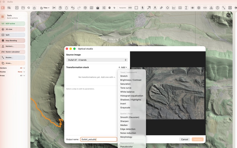
LiDAR, optical imagery and vector layers live side by side, in the same coordinate system, on the same screen. Switch between 2D and 3D, or split the window and work in both at once.

TOPOGRAPHY AND HYDROLOGY
Contour lines, spot elevations, longitudinal profiles and cross sections, volumes, visibility analysis, corridor studies, stakeout grids, gentle-slope routes, drainage networks, watersheds and rainfall simulation.

ANALYSIS
Raster calculator with full map algebra, zonal statistics, interpolation by IDW, TIN or ordinary kriging with an automatically fitted variogram, kernel density, terrain derivatives, spectral indices, band composites, and supervised classification with Random Forest.

VECTOR GEOPROCESSING
Buffer, dissolve, intersect, union, difference, clip, simplify, convex hull, Voronoi and Delaunay, on a geometry engine written from scratch for this app.

FIND PATTERNS BY EXAMPLE
Draw one example of what you are looking for and the morphological radar finds the rest across the whole terrain. Or let the automatic landform discovery map peaks, ridges, valleys, hollows and flats with no training at all.

AN AI THAT OPERATES THE APP
Connect Claude, Codex or any MCP client and ask in plain language: generate contours, place markers, run a profile, export to DXF. The assistant works the app for you, with your own API key. Destructive operations stay blocked until you allow them.

DELIVER THE WORK
Export to DXF for CAD, GeoPackage and GeoJSON for GIS, a ready-made QGIS project, CSV, images, and print-ready PDF maps with legend, scale bar, north arrow and title block.

PRIVATE BY DESIGN
Everything runs on your Mac. EasyLidar collects no data about you and sends nothing to us. Your point clouds never leave the machine.

A BUILT-IN MANUAL
The full user manual travels inside the app, with a navigable index, screenshots and worked examples. Available in English, Spanish, French, German, Italian and Portuguese.

REQUIREMENTS
macOS 13 or later, on a Mac with Apple Silicon.