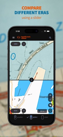
With the Topoferrarisviewer, or in short Topoferraris, you can view the Ferraris Cabinet Map from 1777 and compare it with various historical series of topographic maps from the National Geographic In
With the Topoferrarisviewer, or in short Topoferraris, you can view the Ferraris Cabinet Map from 1777 and compare it with various historical series of topographic maps from the National Geographic Institute. Naturally, the NGI's most recent topographic map at a scale of 1:25,000 is also included. You can choose from a total of 8 map layers depicting the Belgian landscape in different periods over the past 250 years.

If you would like to know which traces of the past are still visible today, or how the landscape you are traveling through has changed over the past 250 years, select one of the walking suggestions or import your own GPX track, and head out with Topoferrarisviewer.