Style

Screenshots
3 screenshots Grid- Version
- 1.0
- Size
- 3 MB
- First release
- Oct 31, 2026
- Category
- Weather
Description
from the App Store listingKeep your boat information close, wherever you are.
Neptune NP2K brings available vessel readings, location, forecasts and trips into a clean interface designed for your phone.
YOUR BOAT AT A GLANCE
Arrange instrument tiles on your dashboard. Swipe supported tiles between digital readings and gauges, then open a reading to explore available 24-hour, 7-day and 30-day history.
MAP AND SHARE
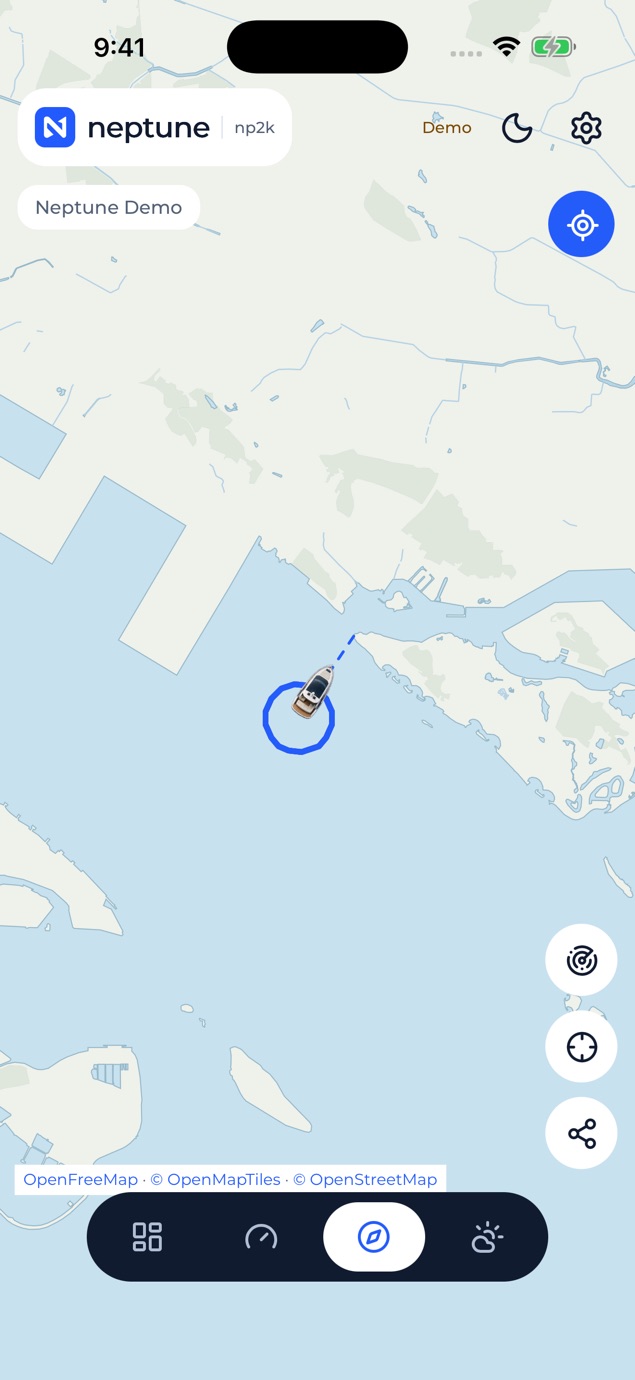
View your boat’s reported position and track on a full-screen map. Share a private tracking link with friends, see active and total viewer browsers, and stop sharing when you choose. Give your boat a profile and an optional custom PNG map marker.
FORECASTS WHERE YOU ARE
Choose boat GPS or phone GPS for local weather and available tide predictions. Phone location permission is requested only when you choose it.
TRIPS AND REPORTS
Start and finish trips, explore recorded routes and available instrument summaries, rename saved trips and download or share a PDF trip report.
FUEL RANGE
Use available fuel quantity, total consumption and GPS speed to estimate one-way and return range. A temporary calculator lets you try other conditions without changing your boat’s readings.
BUILT FOR THE BOAT
Bold readings, touch-friendly navigation and a red night mode keep the interface focused. One Neptune account holds your saved boat details and favourites.
The app is free to download. This version has no in-app subscription purchase. Remote boat monitoring requires a compatible onboard NP2K collector, a supported GPS/NMEA setup, onboard Wi-Fi and internet connectivity. Readings, history, AIS and predictions depend on your equipment, recorded data, provider coverage and connectivity. Viewer counts represent browsers, not verified people.
NP2K supports monitoring and awareness. It is not a certified navigation, collision avoidance, distress or emergency system. Fuel range circles do not model land, routes, currents or weather. Always use appropriate charts, forecasts, equipment and local judgement.
What users say
0 written reviewsNo written reviews yet
Share cards #
Instagram / Weibo / RED open the system share sheet with the generated card image
Neptune NP2K
Weather
Free
iOSAppGallerywww.iOSAppGallery.com


Neptune NP2K
Weather
Free
Scan to view
iOSAppGallery · iOSAppGallery.com
Discover iOS apps & games
Neptune NP2K
Weather
Free
Scan to view
iOSAppGallery · iOSAppGallery.com
Discover iOS apps & games
Neptune NP2K
Weather
Free
iOSAppGallerywww.iOSAppGallery.com


{"@context":"https://schema.org","@graph":[{"@type":"SoftwareApplication","name":"Neptune NP2K","applicationCategory":"Weather","operatingSystem":"iOS","url":"http://iosappgallery.com/en/share/6825242307","image":"https://is1-ssl.mzstatic.com/image/thumb/Purple221/v4/91/37/e9/9137e9e4-a310-86e2-f45e-b14b7597d3b6/AppIcon-0-0-1x_U007ephone-0-1-85-220.png/512x512bb.jpg","aggregateRating":null,"offers":{"@type":"Offer","price":0.000,"priceCurrency":"CNY"}},{"@type":"BreadcrumbList","itemListElement":[{"@type":"ListItem","position":1,"name":"Apps","item":"/"},{"@type":"ListItem","position":2,"name":"Weather"},{"@type":"ListItem","position":3,"name":"Neptune NP2K"}]}]}