CadNav 2: Off-Grid Navigation for the Field
Navigate with confidence, whether you have a signal or not
CadNav 2: Off-Grid Navigation for the Field

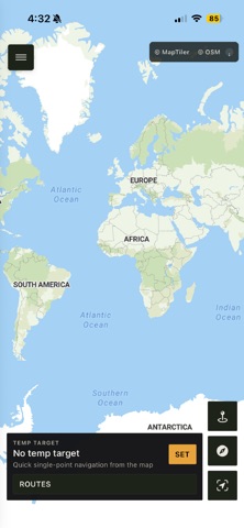
Navigate with confidence, whether you have a signal or not. CadNav 2 is a tactical GPS navigation app built for hikers, orienteers, search and rescue teams, and anyone who ventures beyond cell coverage.

Navigate Offline

Download map regions before you head out. An intelligent tile cache also saves the maps you browse, so they're available even after you lose signal.

Military-Grade Grid Navigation

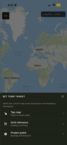
Display a full grid reference overlay with configurable origins, subdivisions, and convergence correction. Set targets by tapping the map, entering a grid reference, or projecting a bearing and distance from your current location.

Compass and GPS, Your Way

Track your bearing, distance, and progress in real time. Switch between degrees and NATO mils (6400 mils), and choose True North or Magnetic North. Magnetic declination is calculated automatically using your location and date.

Practical Route Planning

Create routes with multiple checkpoints, each with custom colors, labels, and emoji icons. Reorder, reverse, or randomize checkpoints, then save routes to your library or export them as JSON.

Battery-Smart GPS Modes

Choose the balance of accuracy and battery life that suits your mission with Best Accuracy, GPS Priority, Power Saving, or Super Saving. Super Saving turns off the map while keeping GPS active, helping your battery last longer when navigation matters most.

Built for the Outdoors

A woodland-inspired color palette and dark mode help preserve your night vision. Available on iPhone.