
Greek Island Streets
0.0 5.46MB 0 Free
Version 1.12
Updated 2026-08-05
Developer Global Outsource Solutions Pty Ltd



Description
The old towns of the Greek islands were built as mazes — that's the magic, and the problem
The old towns of the Greek islands were built as mazes — that's the magic, and the problem. In the Kastro of Naxos, big-name maps show alleys that don't exist and miss the ones that do.

So we walked every single one and mapped them by hand. Greek Island Streets is the map that actually matches the stones under your feet.

FIND YOUR WAY BACK
Scan the QR card at your hotel or Airbnb — or tap it on the map and choose "I'm staying here." From then on, the map always knows the way home. Your place is saved on your phone only, never on our servers.

FIND EVERYTHING ELSE
450+ hand-checked places: tavernas, cafés, bakeries, museums, viewpoints, ATMs, pharmacies, kiosks, luggage storage, public toilets. Browse by category or search — the map frames what's around you.

BUILT FOR THE ALLEYS
Walking directions that follow the real lanes, not roads a car would take. The town map and search work offline once downloaded — directions just need a moment of signal to load, then GPS does the rest.

IN YOUR LANGUAGE
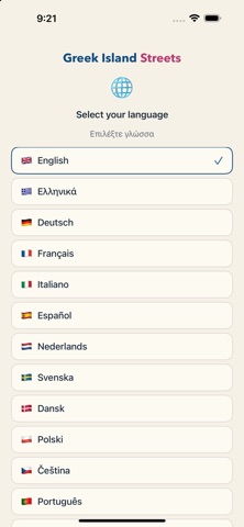
English, Ελληνικά, Deutsch, Français, Italiano, Español, Nederlands, Svenska, Dansk, Polski, Čeština, Português, Русский.

HELP MAP THE ISLANDS
Have an iPhone Pro? Walk the alleys with the built-in LiDAR mapper, contribute centimetre-accurate street data, and earn points toward partner rewards. The camera is used only for motion tracking — no photos or video are ever saved or uploaded.

Now covering Naxos (Chora). More Cycladic old towns coming for the 2027 season.
CategoryLabel旅游(57928)
VersionLabel1.12
BundleId: com.pathmapper.lidarcapture
DeveloperLabelGlobal Outsource Solutions Pty Ltd
LastUpdatedLabel2026-08-05
